Click "Add To Cart" button to download.

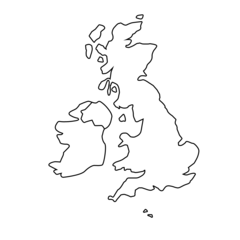
Map of the UK showing Northern Ireland/Irish Border
Sale price
£0.00
Regular price
£1.00
England is part of the United Kingdom. England became a unified state during the 10th century and takes its name from the Angles, one of a number of Germanic tribes who settled in the territory during the 5th and 6th centuries. The capital city of England is London, which is the largest city.

Map of the United Kingdom
This is a map of the UK United Kingdom) showing England, Wales, Scotland, and Northern Ireland. Ireland is shown.

Free Shipping
Items ordered on this website have free shipping.
Shipping Questions
Please contact us if you have a question relating to shipping.